Table of Contents
As we navigate the dawn of 2023, the integration of geospatial technology and artificial intelligence — commonly referred to as GeoAI — stands at the forefront of a technological renaissance in machine learning. This powerful synergy has birthed a series of visionary and inspiring advances that are not just reshaping the capabilities of machine learning but are also setting the stage for a future where the real and digital worlds converge seamlessly.
From enabling smarter cities that pulse with IoT connectivity to unlocking the mysteries of Earth’s intricate ecosystems through enhanced satellite imagery, GeoAI is the linchpin in a series of groundbreaking developments.
What is GeoAI?
GeoAI, short for Geospatial Artificial Intelligence, is an innovative field at the intersection of geographic information system (GIS) technology and artificial intelligence (AI). It’s a domain that leverages machine learning, deep learning, data mining, and big data analytics to extract meaningful information from geospatial data—data that is related to the location, shape, and relationship of objects within a geographical space.
The essence of GeoAI lies in its ability to process and analyze large amounts of spatial data quickly and accurately. This can include anything from satellite images and aerial photographs to GPS data and mapping information.
From the integration of GeoAI with burgeoning technologies to its role in pivotal societal challenges, we stand on the brink of a new horizon of possibilities, with GeoAI as our guide and machine learning as our compass.
As technology advances, GeoAI can help create more resilient ecosystems. By monitoring and managing natural habitats, we can enhance their ability to withstand environmental stressors and disruptions. To explore seven groundbreaking advancements in GeoAI that are poised to shape the future.

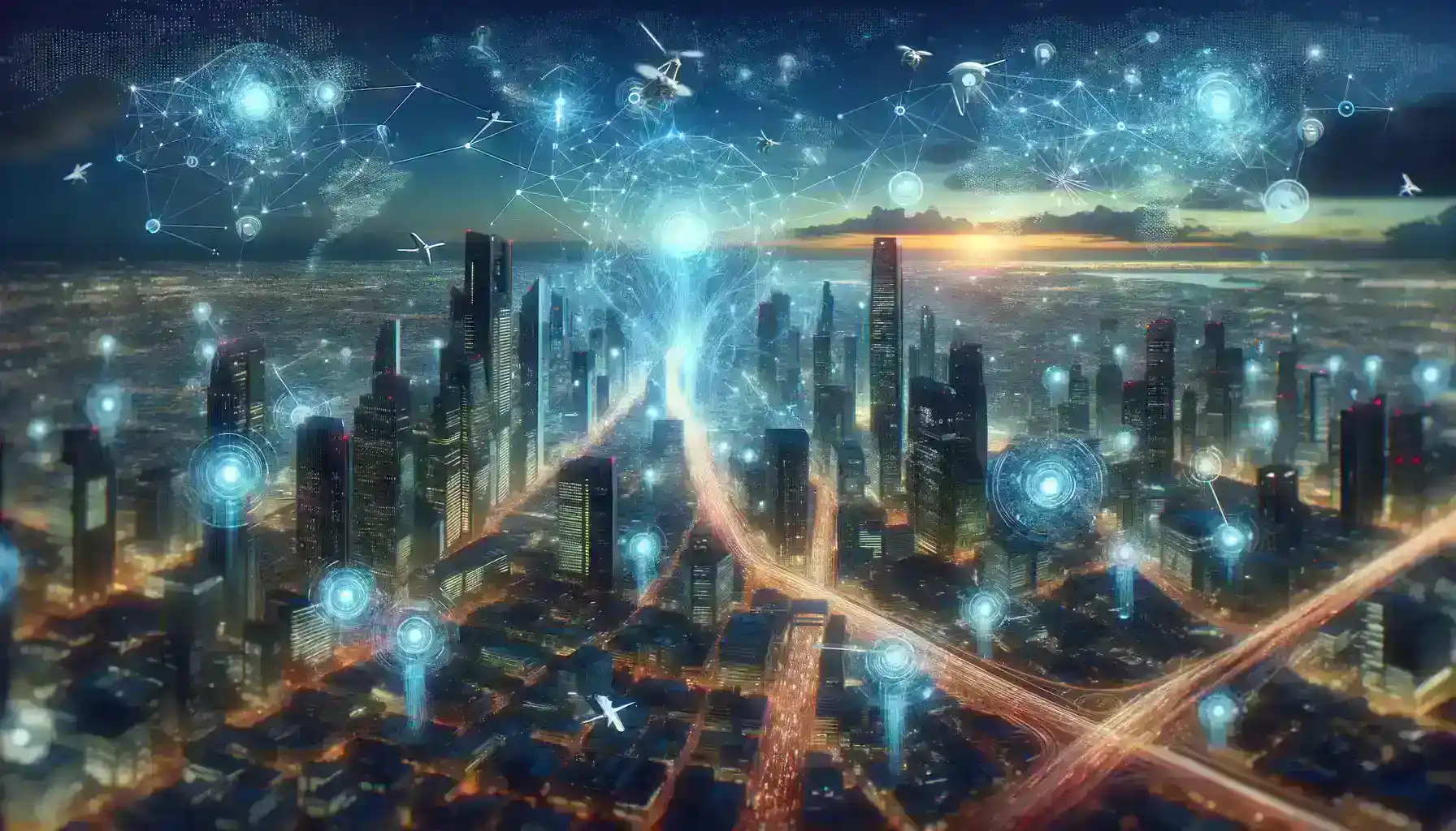
1. Integration of GeoAI with IoT for Smart City Solutions
The convergence of GeoAI with IoT has been pivotal in evolving urban environments into smart cities. In 2023, this integration has led to the development of advanced urban ecosystems that are more responsive to the needs of their inhabitants. AI-driven traffic management systems have been deployed that analyze data from a network of IoT sensors to optimize traffic flow and reduce congestion in real time.
Environmental monitoring has been enhanced through IoT devices that collect data on air quality, noise levels, and water quality, with GeoAI algorithms processing this information to provide actionable insights. Urban planning assists planners by simulating the impacts of various development scenarios, aiding in sustainable and efficient city design.
In Rio de Janeiro, Brazil, GeoAI and IoT are used for disaster preparedness and response. IoT sensors are deployed in areas prone to landslides and flooding, collecting data on soil moisture levels, rainfall, and river water levels. GeoAI models analyze this data to predict potential disasters and trigger early warning systems.
2. Advancements in Satellite Imagery Analysis
Spatial Intelligence has significantly transformed satellite imagery analysis by increasing both resolution and accuracy. Machine learning algorithms have been refined to interpret satellite data more precisely, allowing for improved monitoring of environmental changes.
In 2023, advancements in neural networks have enabled the detection of subtle changes in vegetation health, urban sprawl, and water bodies, supporting efforts in climate change mitigation and urban management.
Advancements in satellite imagery analysis have significantly improved our ability to monitor and combat deforestation in critical regions such as the Amazon rainforest. State-of-the-art satellites equipped with high-resolution cameras capture detailed images of forested areas. These satellites orbit the Earth, providing frequent updates and large-scale coverage.
3. Breakthroughs in Real-time Geographic Data Processing

2023 has witnessed major breakthroughs in real-time geographic data processing, substantially reducing the time needed to derive insights from geospatial data. These innovations have been crucial in disaster response, where rapid assessment can save lives and resources. Logistics companies are leveraging these advancements to optimize routing and supply chain management by processing real-time traffic and weather data.
IoT sensors were deployed at critical locations, including seismic sensors to detect ground movements, rainfall, and river water level sensors. These sensors continuously collect real-time data related to environmental conditions. Nepal, a country prone to natural disasters like earthquakes and landslides, has leveraged breakthroughs in real-time geographic data processing to enhance disaster response efforts.
4. Enhanced Predictive Analytics for Climate Change
GeoAI’s role in combating climate change has been underscored by its enhanced predictive analytics capabilities. By analyzing complex patterns in environmental data, models powered by Spatial Intelligence can forecast weather events and long-term climate shifts with greater accuracy.
The National Oceanic and Atmospheric Administration (NOAA) operates the Climate Prediction Center (CPC), which utilizes enhanced predictive analytics to provide real-time climate forecasts and monitor climate change impacts. NOAA’s CPC employs sophisticated climate models that incorporate historical climate data, current observations, and the latest advancements in climate science.
5. Spatial Intelligence in Autonomous Vehicle Navigation
Spatial Intelligence has become an indispensable tool for conservationists and ecologists, particularly in monitoring and protecting biodiversity. Novel tools were developed in 2023 that utilize remote sensing and spatial analytics to track wildlife movements, assess habitat health, and monitor changes in biodiversity over time, thereby informing conservation strategies.
Waymo, a subsidiary of Alphabet Inc. (Google’s parent company), has been at the forefront of autonomous vehicle development. They have been testing their self-driving cars in Phoenix, Arizona, and these vehicles prominently utilize Spatial Intelligence for safe and efficient navigation.
Waymo vehicles are equipped with a sophisticated sensor suite, including LiDAR (Light Detection and Ranging), radar, cameras, and GPS. These sensors continuously capture a vast amount of spatial data from the vehicle’s surroundings.
6.GeoAI-Powered Conservation and Biodiversity Monitoring
Spatial Intelligence has become an indispensable tool for conservationists and ecologists, particularly in the monitoring and protection of biodiversity. Novel tools were developed in 2023 that utilize remote sensing and spatial analytics to track wildlife movements, assess habitat health, and monitor changes in biodiversity over time, thereby informing conservation strategies.
The Department of Health and Mental Hygiene(DOHMH) collects a vast amount of health-related data, including information on diseases, healthcare access, and social determinants of health, such as income and education levels. Gabon, a country known for its rich biodiversity and dense rainforests, has implemented GeoAI-powered conservation drones to monitor and protect its unique ecosystems and wildlife.
7. Social Impact: GeoAI in Public Health and Urban Development
The social impact of Spatial Intelligence is evident in its applications in public health and urban development. It has been used to map disease outbreaks, analyze social determinants of health, and optimize the placement of public amenities. In 2023, projects utilizing Spatial Intelligence have been instrumental in creating healthier living environments and enhancing the quality of life in urban settings.
Health sensors are deployed throughout the city to monitor various environmental factors, including air quality, noise levels, and temperature. These sensors continuously collect data in real-time. Amsterdam has implemented a cutting-edge AI-driven system for public health and urban development, focusing on improving its residents’ well-being. This system combines GeoAI and IoT technologies to create a healthier and more livable urban environment.
Conclusion
The discussed advancements in GeoAI represent a remarkable leap forward in our ability to harness spatial intelligence for the betterment of society. These innovations, coupled with IoT technology, have the potential to revolutionize various sectors and shape a brighter future.
The integration of GeoAI with IoT for smart city solutions leads to more efficient traffic management, improved environmental monitoring, and sustainable urban planning. This means reduced congestion, cleaner air, and cities that are more responsive to the needs of their inhabitants.
GeoAI-powered conservation and biodiversity monitoring tools are aiding in the protection of natural habitats and wildlife. The importance of continued innovation in GeoAI cannot be overstated. As technology advances, so does our ability to address complex challenges facing our world. With ongoing research and development, GeoAI has the potential to unlock even more powerful insights, drive sustainability, and enhance the resilience of our societies.
Spatial Intelligence is a transformative force that touches on numerous aspects of our lives, from the way we navigate cities to how we protect our environment and health. The positive changes it brings to various sectors underscore its significance in shaping a brighter and more sustainable future. As we continue to innovate in this field, we hold the key to unlocking solutions to some of the most pressing challenges of our time. GeoAI is not just a tool; it’s a beacon of hope for a better world.
Spatial Intelligence is not merely a tool; it’s a beacon of hope for a better and more sustainable world. Through continued innovation, GeoAI has the potential to unlock powerful insights, drive sustainability, and enhance the resilience of our societies, all while preserving the beauty and diversity of our natural world. It embodies our capacity to address complex challenges and create a brighter future for generations to come.